Data Management
Overview
Harrison Group is committed to continually improving its’ data processing tools and data management systems. The results of these developments include:
- Integrated geotechnical and geoenvironmental data management system
- Data available in relational formats (such as AGS 4.0)
- Ground modelling capabilities
- GIS capabilities
- Historic data conversion
Integrated Data Systems
Harrison Group uses HoleBASE SI, developed by Keynetix, to manage its geotechnical and geoenvironmental project data. The company has also developed its’own software to support HoleBASE SI.
The Project Inputting Tool (PIT) allows the conversion of fieldwork, in-situ testing and monitoring data, directly into the AGS 4.0 format, while also automating and validating the data as it is processed.
External suppliers of data, such as laboratories, are also requested to supply data in this format, resulting in quality checks and analysis processes being undertaken rapidly and accurately.
The integrated setup of this system has resulted Harrison Group qualifying as a BIM level 2 organisation.
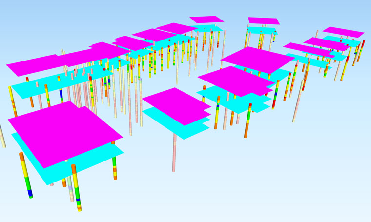
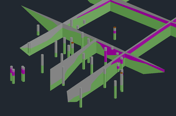
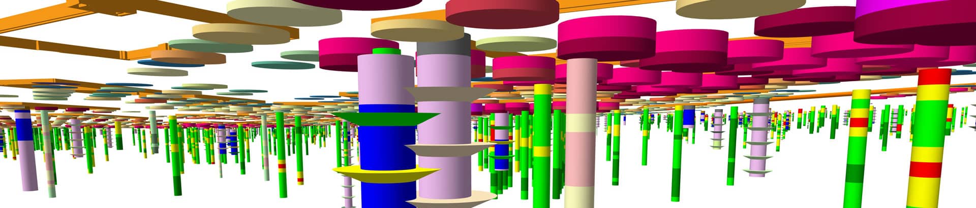
Data Visualisation
Harrison Group uses additional software to interpret data giving detailed 3D visualisations.
Autodesk Architecture, Engineering and Construction (AEC) Collection, which includes licences for Civil 3D, Infraworks and Revit are some of the additional software packages subscribed to.
Keynetix has also developed an extension to Civil 3D which assists with strata-modelling. Infraworks and Revit allow for improved assessment and visualisation of construction models alongside ground data. Harrison Group also has GIS capabilities, which brings additional functions of analysis and visualisation when working with the relational datasets.
Historic Data Conversion
With its’ advancements in data processing, Harrison Group also has the capability of digitising historic data; from handwritten logs to paper-based laboratory reports. Although not guaranteeing the accuracy of the source data, having the ability to interrogate such datasets electronically brings additional benefits and opportunities.
With the restricted nature of historic documentation, Harrison Group provides a Limitations and Assumptions brief to support the converted data. This brief outlines the scope of the conversion undertaken and will either indicate where gaps have been filled, or where inferences have been made from the available sources of information.