Great Yarmouth, Third River Crossing
LOCATION: Great Yarmouth, Norfolk
PROJECT TYPE: Supplemental site investigation, risk and waste assessments
VALUE: £40K
BACKGROUND
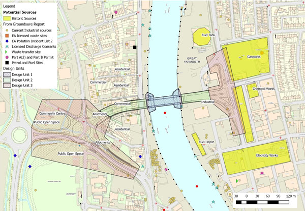
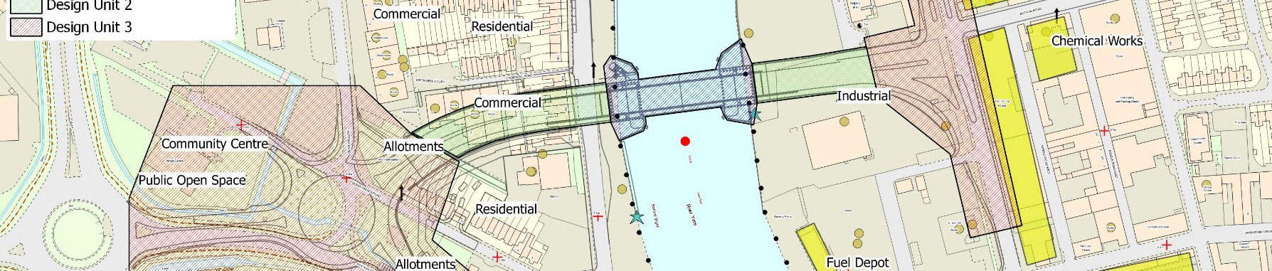
The proposed Great Yarmouth Third River Crossing scheme will provide an additional route over the River Yare. This will involve the construction, operation and maintenance of a new bascule bridge.
It will provide a connection between the strategic road network (A47) and the businesses and commercial parks located on the South Denes Peninsula
In order to gain a Development Consent Order the Planning Inspectorate is required to submit a report and recommendations to the Secretary of State.
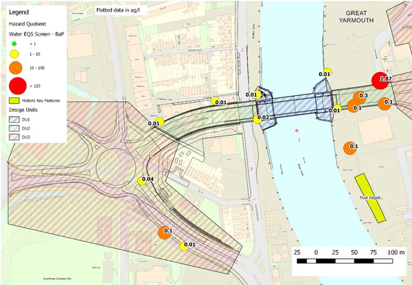
As part of this, Harrison Group were employed to carry out a supplemental site investigation, risk assessment, and waste assessment interpretative report for environmental data, in addition to a wider geotechnical site investigation.
SCOPE OF WORK
The interpretative report builds combines the information gathered from a number of different documents.
These are prepared as part of the Environmental Statement and other design documents regarding site history and land use, groundwater and soil testing, baseline geology and hydrogeology, designation of stratigraphy and water bearing units, critical receptors, and Conceptual Model and Detailed Quantitative Risk Assessment (DQRA).
The specific tasks completed were:
Once completed Harrison Group were able to:
OUTCOME
The work is ongoing.