Archives: Case Studies

Harrison Group case studies

PV Solar Farm Investigations


PV Solar Farm Investigations

LOCATION:   England, Wales & Scotland

PROJECT TYPE:   Geotechnical site investigations, pile testing

VALUE:   £1.2M

BACKGROUND

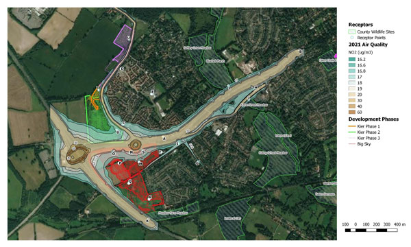
The renewable energy industry is rapidly expanding within the United Kingdom, with many photovoltaic array developments being undertaken to meet growing sustainable energy demands.

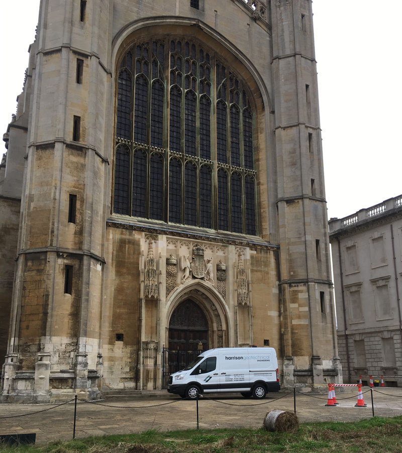
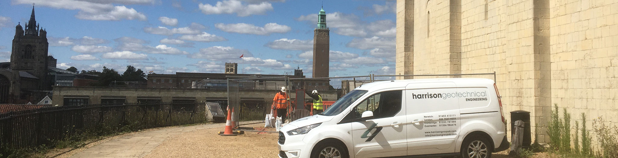
Harrison Group Environmental has successfully completed ground investigations on 25 proposed solar farms across the UK for a range of domestic and international clients in the last two years, at site locations ranging from Somerset, Essex, Sheffield, Anglesey, and the Scottish Borders.

Works were undertaken to provide information for photovoltaic array developments as well as associated infrastructure, including substations, transformer and inverter stations, construction compounds, and access roads.

A wide range of ground conditions were encountered, varying from quaternary age soils of glacigenic, river terrace, and head origin to bedrock geologies comprising mudstones, schist, and coal measures, with our investigation scopes tailored accordingly at each site.

SCOPE OF WORK

A range of preliminary works were required ahead of commencement of each ground investigation. These included:

  • Undertaking preliminary risk assessments (phase 1 desk study).
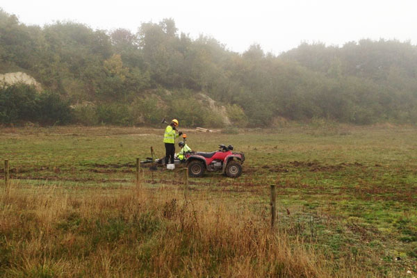
  • Provision of preliminary and detailed unexploded ordnance (UXO) threat assessments with on-site magnetometer surveys and supervision by specialist technicians.
    Underground service tracing.
  • Obtaining coal mining authority permits for works within a backfilled historical open-cast coal mine.

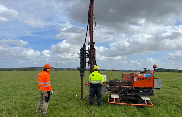
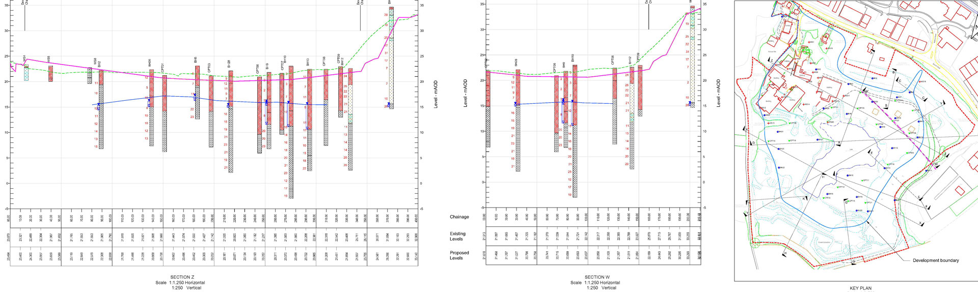
The scope of the ground investigation comprised a range of methodologies, tailored to suit the specific development requirements and site conditions.

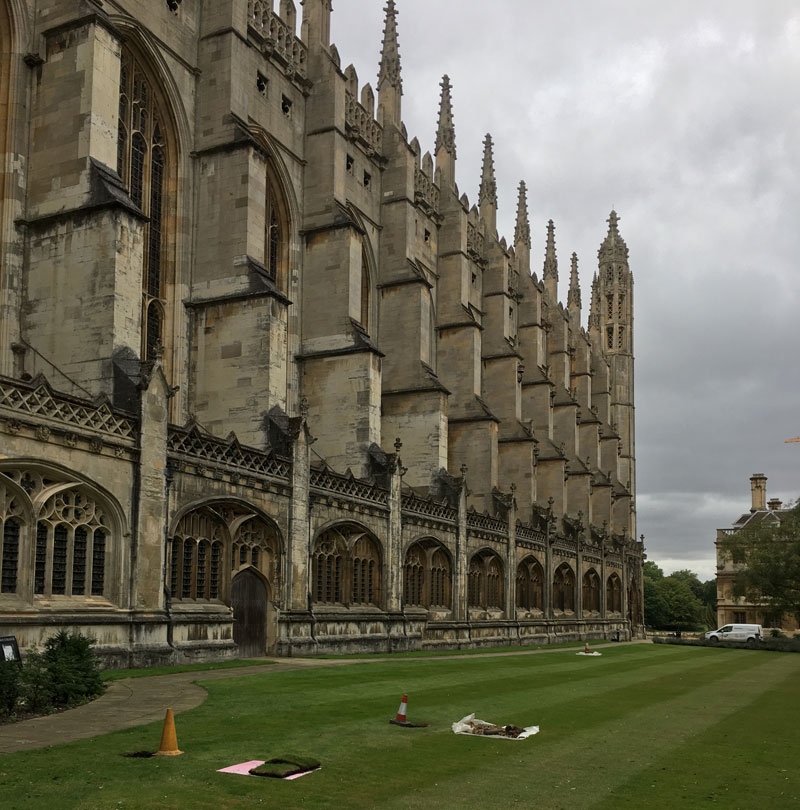
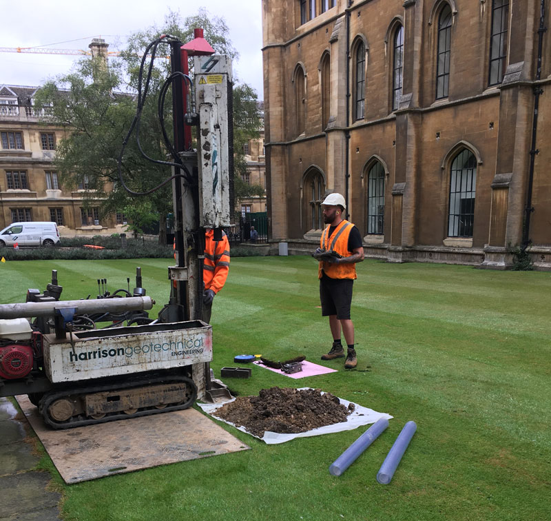
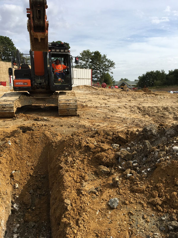
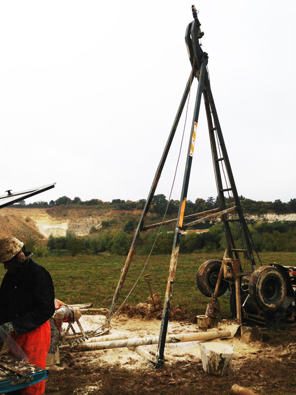
Exploratory investigation included rotary cored, cable percussive, and dynamically sampled boreholes, dynamic penetration testing, and machine excavated trial pits.

Detailed in-situ testing was undertaken at each site to provide quantitative data to inform the ground model and allow determination of geotechnical design parameters.

The test methods included:

  • Plate bearing and California Bearing Ratio tests for crane lift and construction compound areas.
  • TRL dynamic cone penetrometer and lightweight deflectometer tests along access routes and haul road alignments.
  • Hand shear vanes.
  • Pocket penetrometers.
  • In-situ thermal resistivity testing was completed on proposed buried cable routes.

A range of laboratory tests for geotechnical classification alongside thermal and electrical resistivity were undertaken on samples recovered from exploratory positions and imported soils, as well as geoenvironmental contamination suites and waste classification (WAC) testing.

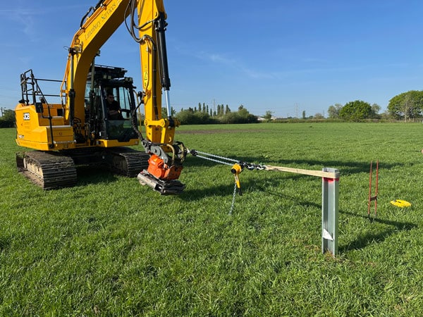
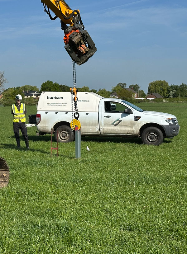
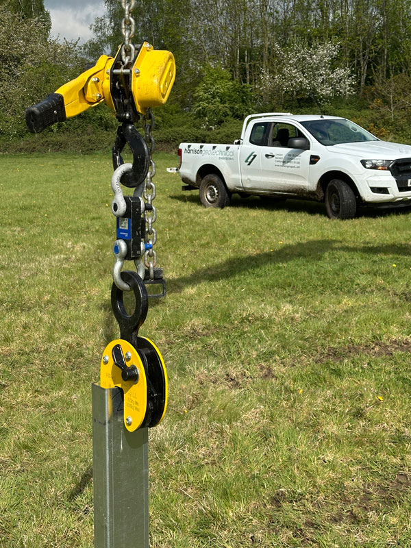
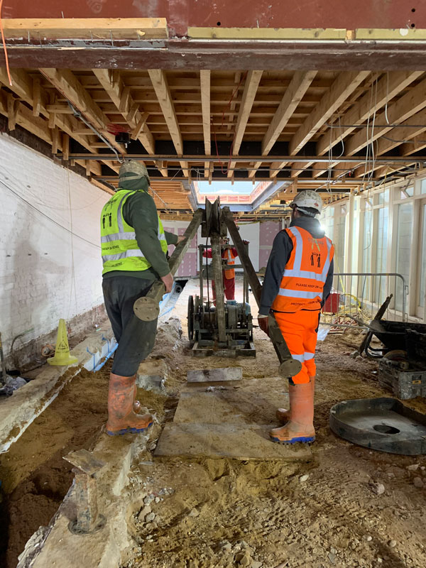
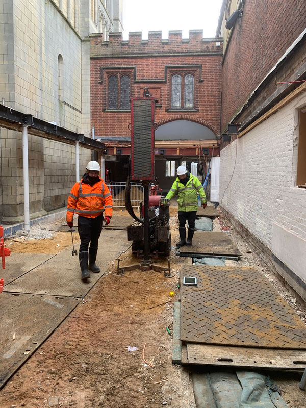
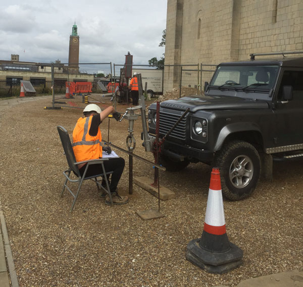
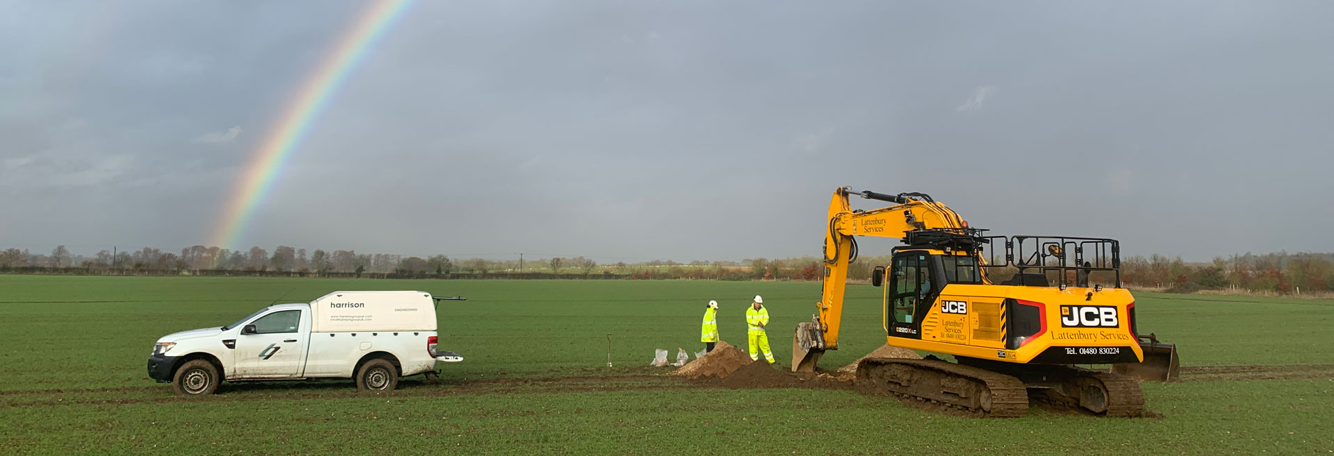
Driven steel piles are generally the preferred foundation solution for photovoltaic arrays. However, accurate assessment of drivability and load capacities must be undertaken to determine their suitability on a site-specific basis.

For many of the sites, sacrificial test piles were installed to a range of depths. This allowed the completion of lateral and axial load testing, enabling the measurement of deformation and elastic rebound responses to the applied loads.

OUTCOME

The investigations overcame a range of access restrictions and poor surface ground conditions to deliver results quickly and effectively to the clients, while minimising inconvenience and disturbance to landowners and local stakeholders.

Harrison Group also delivered interpretative reports confirming the geological and environmental baseline conditions, and information on hazards and constraints present at each site, which could impact the design and construction phases.

Detailed recommendations and advice were provided which would be incorporated by the client at the design stage.

This included geotechnical parameters for soil and rock, subgrade suitability for roads, shallow foundation solutions including bearing capacity, pile capacity (both in compression and tension) and pile driveability assessment.

All solar farm projects have been completed successfully by Harrison Group, with site works and written reporting all supported by a comprehensive quality management system.

View full details here.

Lateral pile testing


Axial pile testing


Test pile installation


King’s College, Cambridge


King’s College, Cambridge

LOCATION:   King’s College, Cambridge

PROJECT TYPE:   Geotechnical site investigation

VALUE:   £7K

BACKGROUND

King’s College Chapel is a Grade 1 listed collegiate chapel of the University of Cambridge, built in the 16th century and located in the heart of the historic city centre. Currently, repair work to the roof is programmed to be undertaken; and this is to be done whilst allowing the chapel to continue functioning as an active place of worship, as a home to King’s College Choir and to also accommodate the steady daily stream of visitors to the building.

Sizeable scaffolding would be required, to allow access for the work to take place. Due to the resultant mass of these temporary works, a ground investigation was required to assess the load bearing characteristics of the ground supporting the scaffolding, to ensure that the structure would be safe and secure.

In addition to this, an investigation was also required to establish groundwater levels underlying the chapel itself, providing information relating to planned conservation activities.

SCOPE OF WORK

Three boreholes were completed to a maximum depth of 4.45m, using a tracked window sampler rig. Matting was placed on the ground to prevent the tracks causing damage to the lawns, with the soil samples collected on plastic sheeting and logged by a geotechnical engineer.

In addition to this, in-situ testing was undertaken comprising dynamic cone penetrometer and lightweight deflectometer tests to determine the maximum allowable bearing capacity for the scaffolding bases.

Furthermore, five inspection pits were completed to investigate the construction and condition of the existing foundations of the chapel buttresses. These were hand-excavated to minimise possible damage to the integrity of the foundations and buried utility services.

It was essential that the University of Cambridge activities in the chapel and surrounding areas remained unaffected by the fieldwork operations. Measures were taken by Harrison Group to ensure this, which, for example, included minimising noisy activities during a performance by King’s College Choir inside the chapel.

Due to the sensitive nature of the location, it was necessary to leave the site in a pristine condition on completion of the fieldwork.

OUTCOME

The fieldwork was completed in two days, with investigation at 42 locations. Ground conditions were found to comprise extensive made ground (soil containing anthropogenic material), underlain by River Terrace Deposits. Gault Formation clay was proven at depth.

The buttress footings of the chapel were found to extend to depths in excess of 1.50m.

Ground bearing capacity at the locations of the scaffold bases was found to be satisfactory in all cases to allow for the use of conventional load spreaders, thus avoiding the time and cost penalties of additional temporary works.


Norwich Castle Keep Restoration


Norwich Castle Keep Restoration

LOCATION:   Norwich

PROJECT TYPE:   Geotechnical site investigation

VALUE:   £15K

BACKGROUND

Harrison Group was contracted by Morgan Sindall to carry out several phases of site investigation work at Norwich Castle during 2020 and 2021.

The work was part of the ambitious project to restore the castle keep back to the original layout that existed in the 12th century.

As the proposed alterations to the building’s structure would increase loadings on internal walls and foundations, the investigations were required to provide ground information to aid pile design, give clearance to proceed at a number of proposed piling locations and for the safe construction of temporary works.

Previous site investigation at Norwich castle had identified granular made-ground with cohesive bands up to 10m depth, forming the structure of the castle mound. Also, a Saxon burial site may have been encountered, with historical investigation findings revealing the presence of bone fragments at around 8.5m depth. Underlying this, sand and gravel of the Crag Group and Norwich Chalk had been encountered.

SCOPE OF WORK

For this current phase of work, a number of investigative techniques were employed, including: –

  • Cable percussive borehole (electric-powered low-headroom rig), depth 25m
  • Dynamic Continuous Sampling (DCS) boreholes
  • Dynamic Probe Testing (DPT)
  • Plate Bearing Testing (PBT), completed within the Castle Meadow area of the site in order to provide information for construction of a temporary crane base
  • In-situ California Bearing Ratio tests for temporary works
  • Archaeologists worked alongside Harrison Group as they were required to pre-dig the drilling locations, in order to check for artefacts, prior to the intrusive works being undertaken.

    Due to the large quantity of made-ground encountered, which is inherently variable, geotechnical laboratory testing was considered of limited use in yielding meaningful results.

    However, potential reaction of the soil with buried concrete was a consideration, and soil samples were sent to a UKAS/MCERTS accredited laboratory for testing.

    Pile installation was programmed as part of the development works, to be undertaken (by others) around the castle keep. To assist with this, Harrison Group provided factual data as their works progressed, to allow the piling contractor to assess the suitability of anticipated piling locations and as an aid to their pile design before mobilising to site.

    OUTCOME

    All site operations were carried out successfully whilst respecting COVID-19 rules.

    Harrison Group was also flexible with the site works and liaised closely with Morgan Sindall to prioritise their needs, completing the work on time and within budget.

    Setting up low-headroom drilling rig


    DPT rig setup


    CBR testing


    Happisburgh


    Happisburgh

    LOCATION:   Happisburgh, Norfolk

    PROJECT TYPE:   Geotechnical site investigation

    VALUE:   £100K

    BACKGROUND

    Harrison Group was contracted by Vattenfall to undertake a site investigation over a section of Happisburgh beach to provide information on ground conditions for the design of the cable landfall for the Norfolk Vanguard and Norfolk Boreas offshore windfarms. These sites will have a combined generating capacity of 3.6 GW, providing the equivalent electricity needs of 3.9 million UK homes per year.

    SCOPE OF WORK

    The site comprised a part of Happisburgh beach situated below a cliff section which was inaccessible to road vehicles without extensive enabling works. It was therefore decided to access the site by sea, utilising a landing craft to transport all plant, equipment and materials onto the beach. The timing of the site work was chosen specifically to coincide with neap tides (when the tidal range is the smallest), so the fieldworks did not run the risk of inundation by the sea.

    MTS Group Limited provided the landing craft MTS Terramere to transport the plant and equipment from the Port of Lowestoft directly to Happisburgh beach. Equipment was then transported between the vessel and the worksite by tracked plant.

    A UXO supervisor was present onsite to verify that the work area was clear of shallow buried ordnance prior to setting up drilling and testing equipment. A paleoarchaeologist was also present to ensure that the fieldworks did not disturb potential archaeological artefacts.

    The site works comprised drilling a single cable percussive borehole and undertaking five cone penetration tests across the proposed cable route. The cable percussive borehole was advanced to a depth of 21.5m utilising specialist tooling and several casing diameters – reduced through bentonite seals – to minimise the effect of ‘blowing sand’ conditions.

    Closely spaced sampling and in-situ testing was undertaken throughout the borehole and the soils were logged onsite by both a senior geotechnical engineer and the paleoarchaeologist. Cone penetration testing was undertaken to depths of between 8.5m and 15.7m, using a 15-tonne capacity hydraulic ram set mounted on a tracked unit.

    Upon completion of the works, all plant and equipment was removed from the beach by the landing craft and the area was reinstated to an ‘as found’ condition.
    Samples recovered from the borehole were transported back to the company’s laboratory for subsequent testing with results included in the ground investigation report.

    OUTCOME

    Despite the unusal challenge of mobilising to and from a site with restricted access, Harrison’s innovative and proactive approach allowed these works to be completed safely and successfully, on time, with due care to minimise inconvenience to other beach-users and to Vattenfall’s satisfaction.

    View PDF

    Mobilising to site


    Drilling compound


    Typical Vattenfall wind turbines


    Site set up across Happisburgh beach


    ExCel Exhibition Centre, London


    ExCel Exhibition Centre, London

    LOCATION:   ExCel Exhibition Centre, London

    PROJECT TYPE:   Geoenvironmental Ground Investigation

    VALUE:   £100K

    BACKGROUND

    The site investigation took place in the eastern car park of ExCel Exhibition Centre in order to provide information on ground conditions to inform foundation design, contamination assessments, and any remedial measurements required for the construction of a two-storey, 40,000m2 extension.


    The site was immediately adjacent to the Royal Victoria Dock, and had an extensive industrial history with multiple historical foundations. It also had a very high UXO risk, with more than 8 bomb strikes recorded as having occurred on-site and a further 5 within 25m.


    The geology consisted of made ground over superficial deposits including cohesive and granular soils and peat overlaying Lambeth Group deposits.


    At the time of the investigation, Covid-19 restrictions were in place and the ExCel Centre was host to a Nightingale Hospital.

    SCOPE OF WORK

    OUTCOME

    No items found

    Great Yarmouth, Third River Crossing


    Great Yarmouth, Third River Crossing

    LOCATION:   Great Yarmouth, Norfolk

    PROJECT TYPE:   Supplemental site investigation, risk and waste assessments

    VALUE:   £40K

    BACKGROUND

    The proposed Great Yarmouth Third River Crossing scheme will provide an additional route over the River Yare. This will involve the construction, operation and maintenance of a new bascule bridge.

    It will provide a connection between the strategic road network (A47) and the businesses and commercial parks located on the South Denes Peninsula

    In order to gain a Development Consent Order the Planning Inspectorate is required to submit a report and recommendations to the Secretary of State.

    As part of this, Harrison Group were employed to carry out a supplemental site investigation, risk assessment, and waste assessment interpretative report for environmental data, in addition to a wider geotechnical site investigation.

    SCOPE OF WORK

    The interpretative report builds combines the information gathered from a number of different documents.

    These are prepared as part of the Environmental Statement and other design documents regarding site history and land use, groundwater and soil testing, baseline geology and hydrogeology, designation of stratigraphy and water bearing units, critical receptors, and Conceptual Model and Detailed Quantitative Risk Assessment (DQRA).

    The specific tasks completed were:

  • Compilation, integration, and summarisation of historical borehole and chemistry data into a quality controlled georeferenced electronic data set
  • Gap Analysis
  • Supplemental data collection
  • Spatial analysis – data overlayed with historical and proposed land use, site zoning, spatial coverage, initial screening values, traffic light plots
  • Traffic light plot – benzo-a-pyrene in groundwater
  • Statistical analysis – normal probability plots, statistical summaries, assessment of probability distribution, outliers and hot-spots
  • Waste assessment and management based on WM3 waste classification, WAC analysis, and potential for pyritic soils.
  • Once completed Harrison Group were able to:

  • Produce an updated and integrated risk assessment report based on data from all site investigation phases.This reviewed and updated site conditions, development plans, and engineering design and implementation
  • Identify hot-spots and baseline environmental chemistry of different geological units and materials
  • Classify waste and assess re-use and potential material management as per the waste hierarchy – reduce, re-use, recovery and disposal.
  • OUTCOME

    The work is ongoing.

    Site location and environmental information


    Traffic-light plot – benzo-a-pyrene in groundwater


    AQIA, Cringleford, Norwich


    AQIA, Cringleford, Norwich

    LOCATION:   Cringleford, Norwich

    PROJECT TYPE:   Air Quality Impact Assessment

    VALUE:   £10K

    BACKGROUND

    As part of the planning requirements for two proposed residential developments (650 houses over 6 phases) in Cringleford, Norfolk, Harrison Group was commissioned to carry out an Air Quality Impact Assessment (AQIA) on behalf of Kier Living and Big Sky.

    The potential impacts from air emissions and dispersion of pollutants from traffic flows and construction were modelled and compared with relevant legislation, planning policies and Regulatory Air Quality Standards (AQS) and Objectives for the local area.

    SCOPE OF WORK

    The AQIA was completed in accordance with the latest Institute for Air Quality Management (IAQM) and Defra guidance.

    Levels in air of NO2 and Paticlate Matter M10 from road traffic were derived using the Atmosheric Dispersion Modelling System-Roads version 5 emission and atmospheric dispersion model based on traffic density, type and average speeds, source emissions factors, meteorological data, road layout, and location of sensitive receptors.

    Impact was assessed based on modelled changes in local air quality and comparison with AQS and Objectives at sensitive receptor locations, and cumulative effects from other planned or proposed developments in the local area.

    Emissions were calculated using the latest emissions factors from Defra, based on the 2013 and 2026 emission factors respectively within the Emission Factor Toolkit v8.0 incorporated into ADMS-Roads.

    Model verification was completed based on the South Norfolk District Council diffusion tube monitoring data and available co-located traffic data at the following locations.

    OUTCOME

    All work was carried out to the satisfaction of the client.

    • Contour plots showing the ground level concentrations of NO2 for the 2021 With Development and Committed Development scenario were derived
    • All modelled levels at sensitive receptor points were shown to be less than 75% of AQS with less than 2% change relative to AQS compared with baseline levels
    • As per the Institute of IAQM Guidelines the development effects were assessed as having a negligible impact on air quality.

    Road links and sensitive receptors


    Modelled NO2 contours


    Greenyard Frozen, King’s Lynn


    Greenyard Frozen, King’s Lynn

    LOCATION:   Greenyard Frozen, King’s Lynn

    PROJECT TYPE:   Environmental Permitting

    VALUE:   £50K

    BACKGROUND

    Greenyard Frozen, King’s Lynn, is an 80,000 tonnes/pa facility which processes, packages, and distributes a variety of vegetables including, peas, beans, brassicas and a variety of root vegetables.
    The installation includes a main processing factory, two modern packing halls, cold stores and associated infrastructure. In addition to this, process effluent is channelled to an on-site 500,000m3/pa Effluent Treatment Plant (ETP).
    Based on it’s production capacity, Greenyard is required to have an Environmental Permit (EP) for the site in order to meet the requirements of environmental regulations for the food processing sector.
    Harrison Group Environmental provided comprehensive consultancy services, guidance and assistance, from preparing the initial Permit Application, Improvement Conditions, Permit Variations, Site Condition Reports, and Permit Surrender Reports.

    SCOPE OF WORK

    Harrison Group has worked with Greenyard Frozen (originally Pinguin Foods) since 2005. At this time we provided consultancy services to the company, resulting in the successful application for the initial EP (known at the time as a PPC permit) covering the installation.
    We worked closely with our client to ensure a cost-effective response, appropriate to the needs of the facility. This included consideration of Best Available Techniques (BAT), environmental emissions and impacts, Environmental Management Systems (EMS) and resource efficiency audits.

    Since 2005, Harrison Group has provided full support for the EP Improvement Programmes including:-

    • Waste minimisation audits
    • Noise management plans
    • Odour management plans.

    Also substantial variations to the EP were negotiated and secured for the following:-

    • Land acquisition for a new Cold Store and Permit Surrender of a parcel of land to a large supermarket chain. Harrison Group provided site investigation Due Diligence reports, Site Closure Plans, pre-purchase & post-closure soil and groundwater investigations and remediation assessments for formal permit surrender
    • Addition of a Combined Heat and Power Plant to process biogas from the effluent treatment plant and recover energy via a biogas engine. The application included detailed air quality emission and dispersion modelling to demonstrate compliance with Air Quality Standards as well as production of Management Plans for Environmental Emergency and Accident & Odour.

    OUTCOME

    • Harrison Group ensured that Greenyard Frozen had a successful application for their initial Environmental Permit
    • Future substantial variations to the Permit were negotiated and secured.
    • Harrison Group is supplying ongoing support for the Permit Improvement Programmes.

    Nitrogen level contours from biogas emissions


    Biogas engine


    Great Yarmouth, Proposed Third River Crossing


    Great Yarmouth, Proposed Third River Crossing

    LOCATION:  

    PROJECT TYPE:  

    VALUE:  

    BACKGROUND

    The proposed Great Yarmouth Third River Crossing scheme will provide an additional route over the River Yare. This will involve the construction, operation and maintenance of a new bascule bridge.

    It will provide a connection between the strategic road network (A47) and the businesses and commercial parks located on the South Denes Peninsula

    In order to gain a Development Consent Order the Planning Inspectorate is required to submit a report and recommendations to the Secretary of State.

    As part of this, Harrison Group were employed to carry out a supplemental site investigation, risk assessment, and waste assessment interpretative report for environmental data, in addition to a wider geotechnical site investigation.

    SCOPE OF WORK

    The interpretative report builds combines the information gathered from a number of different documents.

    These are prepared as part of the Environmental Statement and other design documents regarding site history and land use, groundwater and soil testing, baseline geology and hydrogeology, designation of stratigraphy and water bearing units, critical receptors, and Conceptual Model and Detailed Quantitative Risk Assessment (DQRA).

    The specific tasks completed were:

  • Compilation, integration, and summarisation of historical borehole and chemistry data into a quality controlled georeferenced electronic data set
  • Gap Analysis
  • Supplemental data collection
  • Spatial analysis – data overlayed with historical and proposed land use, site zoning, spatial coverage, initial screening values, traffic light plots
  • Statistical analysis – normal probability plots, statistical summaries, assessment of probability distribution, outliers and hot-spots
  • Waste assessment and management based on WM3 waste classification, WAC analysis, and potential for pyritic soils.
  • Once completed Harrison Group was able to:

  • Produce an updated and integrated risk assessment report based on data from all site investigation phases.This reviewed and updated site conditions, development plans, and engineering design and implementation
  • Identify hot-spots and baseline environmental chemistry of different geological units and materials
  • Classify waste and assess re-use and potential material management as per the waste hierarchy – reduce, re-use, recovery and disposal.
  • OUTCOME

    The work is ongoing.

    No items found

    Needham Market Quarry, Suffolk


    Needham Market Quarry, Suffolk

    LOCATION:   Needham Market Quarry, Suffolk

    PROJECT TYPE:   Ground investigation, supplementary contamination & geotechnical assessments and validation

    VALUE:   £165K

    BACKGROUND

    Needham Market Quarry in Suffolk was operated by Needham Chalks Ltd for more than 50 years, having previously been farmland. Hopkins Homes purchased the site for redevelopment, to provide 266 homes.


    Harrison Group was employed at the pre-acquisition stage by Hopkins Homes, to provide factual ground investigation information for consultant Coffey Geotechnics Ltd, and continued to provide geotechnical services throughout design and construction.

    SCOPE OF WORK

    The objective of the main ground investigation, carried out in October 2013 while the quarry was still operational, was to provide geotechnical, groundwater and contamination information. It comprised:

  • 27 cable percussive boreholes, to a maximum depth of 26m, with groundwater and gas monitoring standpipes installed at 15 locations
  • 20 cone penetration tests, to a maximum depth of 15m
  • 20 dynamic continuous sampling boreholes (for investigation next to buildings, vegetation and along the edge of the quarry lake), to a maximum depth of 4.1m
  • 14 machine-excavated trial pits to 3.5m depth and four trial trenches, to 4m depth, to gather data on shallower ground conditions, including material stockpiles
  • Six soil infiltration tests to 1.8m, to provide an overview of drainage potential
  • Geophysical surveys: resistivity and electromagnetic tomography profiling
  • Monitoring ground gas and groundwater levels, plus groundwater sampling.
  •  

    Investigations revealed most of the site was covered with between 0.1m and 13.8m of variable made ground, typically reworked from glacial sand & gravel and Diamicton. This material was excavated to expose the underlying Newhaven Chalk and used as backfill after quarrying or was stockpiled. Ground gas and low levels of soil contamination were also recorded.


    Based on its assessment of the investigation results, Coffey Geotechnics recommended:

  • Ground improvement of an area of thick fill, to mitigate differential settlement
  • Slope remodelling
  • Excavation through an embankment for a new access road
  • Installation of ground gas protection measures
  • Drainage and backfilling of the quarry lake with engineered fill (a new drainage basin was installed as part of the development’s drainage strategy).
  •  

    Hopkins Homes engaged Ingent Consulting Engineers (formerly JMS Consulting Engineers) to develop the engineering design and J Breheny Civil Engineering to undertake groundworks. We were employed to carry out further ground investigation and assessments, between 2015 and 2020, including:

  • Slope stability modelling and assessment, comprising further investigation, laboratory analysis; modelling carried out using Slope/W
  • Advising on the safe working and development of slopes, considering drainage and planned construction of roads and houses
  • Reviewing slope, drainage and earthworks design
  • Assessing ground gas, advising on protection requirements and reducing the area requiring protection
  • Further investigation of the chalk in one area, reducing the need for piling
  • Additional soil infiltration testing, to support detailed soakaway design
  • Site visits to sample and analyse waste generated during groundworks
  • Contamination investigations after earthworks exposed organic and potentially volatile material. Laboratory analysis of samples revealed low levels of PAH contamination
  • Development of the remediation strategy and method statement (agreed with the Regulator), comprising a simple cover system over exposed contaminated material. We also provided validation and verification reports for the client, regulator, warrantee provider and homeowners
  • Assessment of a pocket of asbestos exposed during groundworks to the Control of Asbestos Regulations 2012. Development of the remediation method statement, incorporating asbestos risk in the few plots affected.
  • OUTCOME

    The ground investigations and assessments were completed safely, within the timescales and programme budget and to the satisfaction of the consultants and the client. Hopkins Homes continued to request our involvement at critical stages during design and construction of the homes.


    Gavin Houghton, Head of Technical Services at Hopkins Homes, said:

    “Your investigations allowed a technically challenging site to reach an earthworks strategy conclusion, which facilitated a site, that has stood for many years, coming to fruition as a housing development and this is through the merit of the work of the Harrison’s team. From our experience on this and many other sites, we would recommend the Harrison Group for works of this nature.”

    Machine excavated trial pit


    Geophysical surveying


    CP drilling


    Hopkins Homes staged house construction on the site