Archives: Case Studies

Harrison Group case studies

Crossrail – London


Crossrail – London

LOCATION:   London – various

PROJECT TYPE:   Ground investigation with installation of instrumentation

VALUE:   £130K

BACKGROUND

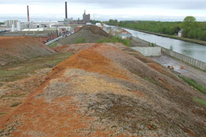
Crossrail represents one of the largest infrastructure projects undertaken in the UK and runs 118 km from Maidenhead and Heathrow in the west, through new twin-bore 21km long tunnels under central London to Shenfield and Abbey Wood in the east.

Upon opening, it is estimated that Crossrail will increase London’s rail-based transport network capacity by 10%, supporting regeneration across the capital and helping to secure London’s position as a world leading financial centre. It will also cut journey times across the city.

The contract for the construction of the Eastern Running Tunnels (contract C305) was awarded to the Dragados Sisk Joint Venture and this included the sections between Royal Oak and Farringdon west (Drive X – length of drive approximately 6.2 km), Limmo Peninsula in the Royal Docks to Farringdon east (Drive Y – length of drive approximately 8.3 km) and Stepney Green to Pudding Mill Lane (Drive Z – length of drive approximately 2.7 km).

SCOPE OF WORK

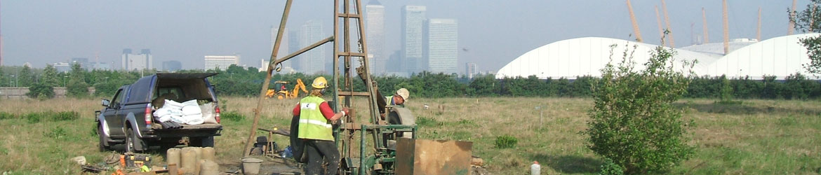
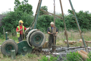
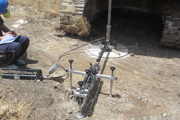
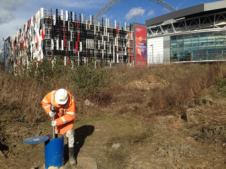
Harrison Group were employed by subcontractor Geocisa UK Limited to drill boreholes and install monitoring instrumentation ahead of the tunnel boring machines. This was done to provide additional information on the geology and a means of monitoring potential ground movements associated with tunnel boring and construction.

Before breaking ground, all drilling positions were monitored for the presence of unexploded ordnance (UXO).

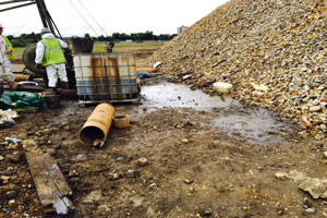
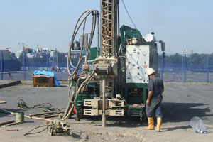
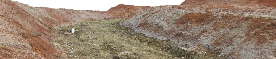
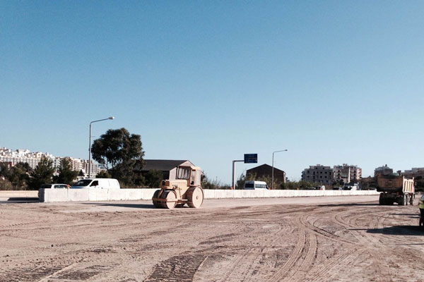
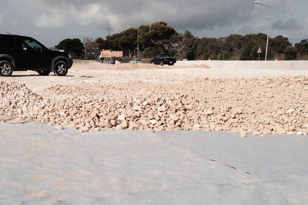
Boreholes were drilled within compounds set up at various locations ahead of the tunnel boring operations. All works were undertaken under a strict Permit to Dig system, which was signed of by a Crossrail representative prior to breaking ground.

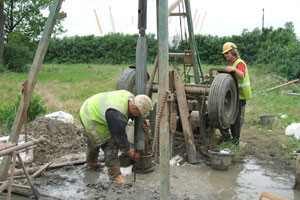
Drilling locations were generally situated within parks and on highways and pavements, where public access required secure compounds to be set up, often within areas underlain by numerous underground services requiring service tracing and clearance systems to ensure safe working practices. All excavations and subsequent reinstatement works were supervised and undertaken by appropriately trained NWRSA-qualified operatives & supervisors.

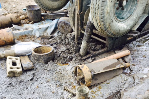
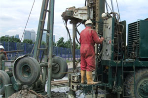
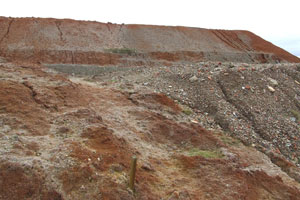
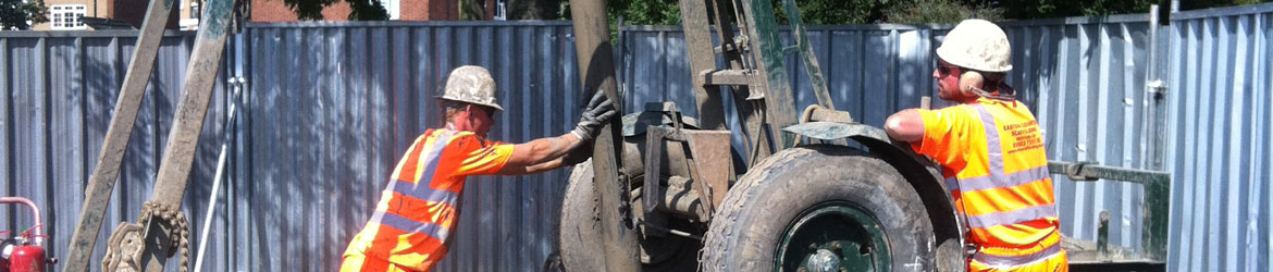
Boreholes were drilled using cable percussive techniques to depths in excess of 40mbgl, requiring the use of multiple drill strings with appropriate environmental seals to prevent potential cross-contamination when boring through made ground.

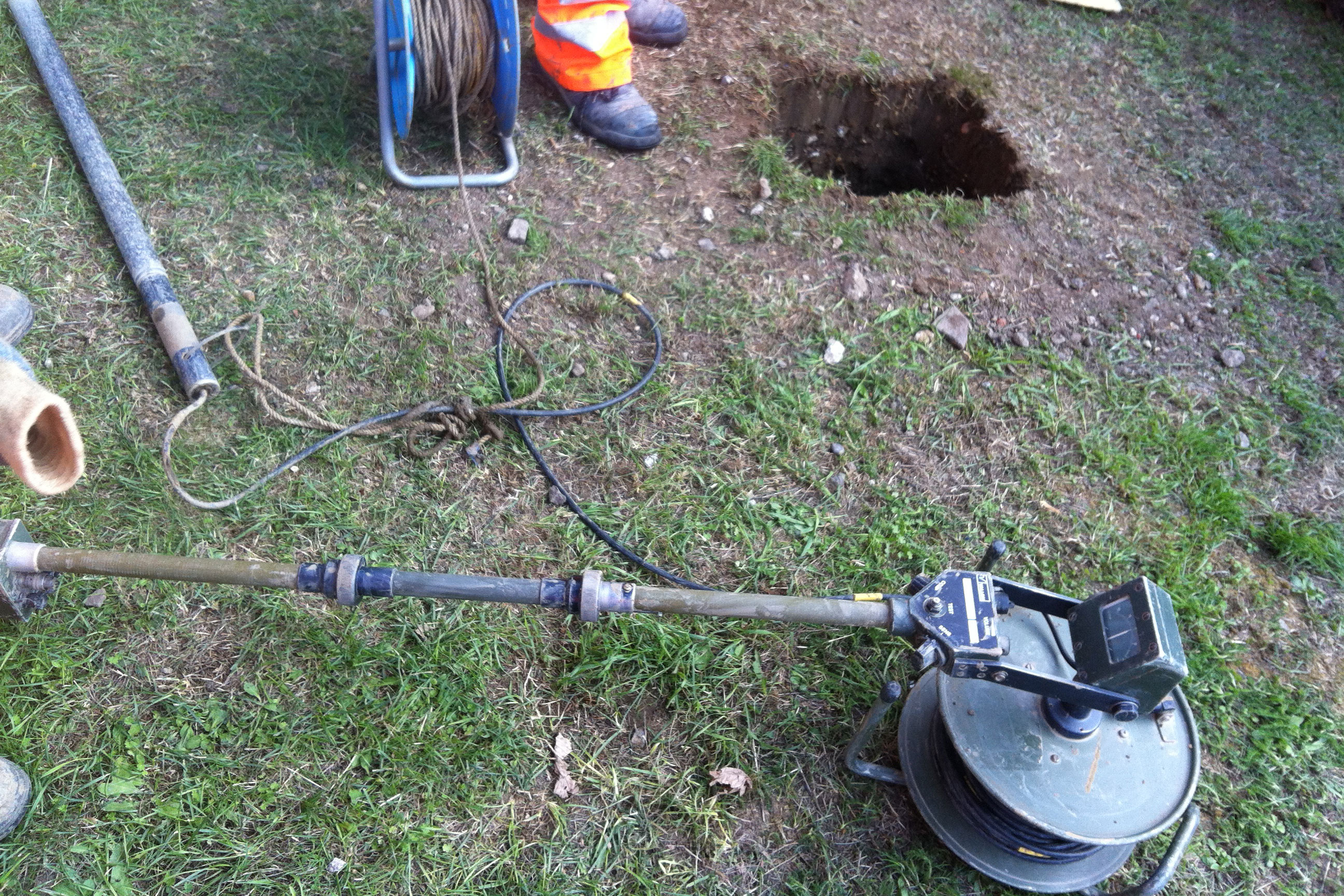
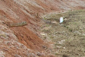
On completion of drilling, instrumentation including vibrating wire piezometers, extensometers and inclinometers were installed in the boreholes and grouted in place. Headworks were then installed and reinstatement undertaken to return the drilling sites to a similar condition to that prior to the works being undertaken.

OUTCOME

All works were successfully completed within appropriate timescales, and to the satisfaction of our client, despite the need to suspend works for certain time periods to allow various local events to take place within public areas.


Lincs OSWF – Lincolnshire


Lincs OSWF – Lincolnshire

LOCATION:   Lincolnshire

PROJECT TYPE:   Ground investigation

VALUE:   £140K

BACKGROUND

The ‘Lincs’ Off-Shore Wind Farm (OSWF) project is just one of 5 wind farms projects which are in various stages of development in the Lincolnshire Wash. The Lincs wind farm alone will provide a total capacity of up to 250 MW supplying electricity to 150,000+ homes.

Harrison Group Environmental was awarded Principal Contractor status by Centrica Ltd., to complete the geotechnical site investigation for the proposed on-shore electricity cable route. This followed the success of our involvement in the Sheringham Shoal wind farm onshore cable route investigation. Our investigation covered the area from the landfall of the cable at Sutton Bridge to the proposed receiving electricity substation at Walpole St. Peter.

SCOPE OF WORK

Our brief was to investigate the ground conditions along the cable route; including examination of the expected geology, testing of geotechnical properties of the soils including thermal resistivity, identification of potential hazards to the directional drilling and foundation recommendations for the sub-station site.

Harrison Group Environmental designed the investigation based on a scope of works provided by the Client. Fieldwork was carried out over a period of three months including access by boat to the intertidal area within The Wash. Intrusive investigation included cable percussive boreholes, cone penetration testing and trial pits. Samples were taken to assess geotechnical properties of the soils. Geophysicl analysis included thermal resistivity of the soils and seismic refraction/reflection to determine the underlying geology of the salt marsh which was inaccessible to plant. Utilities surveys were also carried out at each of the proposed crossings.

OUTCOME

All site works and reinstatement were completed on schedule, without incident and to the satisfaction of the client.

No items found

Greenwich Peninsula – Bugsby’s Reach


Greenwich Peninsula – Bugsby’s Reach

LOCATION:   Greenwich

PROJECT TYPE:   Ground investigation

VALUE:   £60K

BACKGROUND

Bugsby’s Reach South is located on the Greenwich peninsula. The site was historically used as a power station, industrial estate/units and fabrication yard.

As part of the Millennium Exhibition, the area was remediated by removal of contaminated hot spots, then re-graded with a temporary capping layer of clean material.

Redevelopment was planned for the site consisting of residential flats together with infrastructure routes and new open spaces.

SCOPE OF WORK

Prior to the undertaking of intrusive works an Unexploded Ordnance (UXO) survey was carried out. In one instance a suspect metal object was discovered. The Harrison Group’s UXO action plan was implemented, all site works ceased and the area was evacuated. In this case the suspect object was not found to be UXO.

British Drilling Association (BDA) guidelines designated the site as ‘YELLOW’, due to the potential contamination still present. It was also positioned within an Inner Groundwater Protection Zone, so clean drilling techniques were adopted to prevent the potential spread of contamination.

Investigative site works lasted two months and included a variety of site investigation techniques:

Cable percussive boreholes – up to 40m in depth
Rotary boreholes – up to 50m in depth

Window sampler boreholes

Trial pits and trenches

In-situ Californian Bearing Ratio (CBR) tests

Gas/ground water & tidal monitoring

The site works proved challenging as shallow obstructions from previous structures and foundations were encountered.

In addition to this a 1m thick band of limestone was present at approximately 22m depth prevented the deep cable percussion boreholes achieving their required depth.

A rotary drilling rig was employed to penetrate this layer in order to confirm the depth of the Thanet Sand formation.
To complete the site works, all trial pits and trenches within hardstanding areas were reinstated with concrete.

OUTCOME

The site works and reporting were successful and further site investigation work has been carried out by the Harrison Group on the Greenwich Peninsula. We also look forward to additional projects as additional plots become available for redevelopment.

Cable percussive drilling


Cable percussive drilling


Rotary drilling


Rotary drilling


Misurata, Libya


Misurata, Libya

LOCATION:   Misurata, Libya

PROJECT TYPE:   Offshore Environmental Impact Assessment

VALUE:   $260K

BACKGROUND

The underlying objective of the project was to undertake baseline investigations and an assessment of impacts associated with seismic survey activity.

A feature of seismic surveys undertaken during oil exploration is the use of airguns to identify geological structures and sedimentary layers.
The airguns work within the frequency range of 0-120Hz, and, because of this the sounds overlap with the frequency range used by a wide variety of whales and dolphins to both communicate and navigate.

As a consequence, seismic survey activity can impact both marine mammals and pelagic fish species and can induce long term behavioural changes in migration and feeding distribution.

SCOPE OF WORK

In association with our Libyan partners, Harrison Group were contracted to undertake an offshore EIA and pre-seismic survey.

The baseline study used a combination of certified marine mammal observers and a Passive acoustic monitoring system (based on a hydrophone array) to locate, identify, and quantify the abundance of cetaceans (whales and dolphins) in the 100x100km oil exploration block.
Oceanographic conditions were verified through profiling of the water column across the survey area and comparative secondary satellite data.
Socio-economic impacts associated with the distribution and composition of fishing effort were assessed on the basis of physical surveys.
Interviews were undertaken in all vessel landing points and data relating to offshore tuna fisheries acquired from the International Commission for the Conservation of Atlantic Tuna (ICCAT) and other recent assessments of vessel movements in Libyan Waters.
Mitigation of impacts was proposed on the basis of the Joint Nature Conservation Commission (JNCC) guidelines for marine mammal conservation and the provisions of the MARPOL 73/78 Convention (the International Convention for the Prevention of Pollution from Ships).

OUTCOME

All work was carried out within agreed time scales and to the satisfaction of our client.

Seismic survey


Ship’s crew


Survey ship


Survey ship


Olen – Belgium


Olen – Belgium

LOCATION:   Belgium

PROJECT TYPE:   Radioactive stockpile characterisation

VALUE:   £25K

BACKGROUND

The site was originally occupied by a materials technology plant. Activities carried out there included production and extraction of precious metals products and catalysts.
The waste contained some radioactive material and, with support and input from the Belgian environmental regulatory body, the client commissioned Harrison Group to undertake an investigation to determine radioactivity levels and assess their integrity and potential to cause future pollution.

SCOPE OF WORK

Areas under investigation were chemical waste stockpiles resulting from the production of cobalt over 50 years ago.

  • Stockpile 1 contained 280,000m3 of waste material at a depth of approximately 15-20m across an area of 7200m2.
  • Area 2 comprised an area of several hectares where waste was buried to a depth of approximately 3m and capped with a layer of clean material.

Site work comprised two phases:

  • Phase 1: Determination of the extent of the radioactivity within Stockpile 1. Harrison Group supervised the drilling of 50No. cable percussion boreholes and installed 150mm diameter standpipes for radiological monitoring.
  • Phase 2: Determination of the geotechnical parameters of material in Stockpile 1 and Area 2 and analysis of its radioactivity. The site investigation included the drilling of 5No. deep boreholes in Stockpile 1 and a further 10No. shallow boreholes in Area 2. Continual U100 samples were taken and 150mm diameter wells for monitoring radiation were installed.

SPECIAL SAFETY MEASURES
Health and Safety issues are always a priority of the Harrison Group. In this instance there were additional hazard issues surrounding potential contamination from radioactive material.

Prior to setting up the drilling rig and equipment, the ground was scanned with a Geiger Counter. All work was monitored by health physics personnel who continuously scanned arisings and U100 samples before manual handling took place.

In addition, the drilling rig, all equipment and operatives’ protective clothing were screened before moving between borehole positions. Site vehicle and rig were jetwashed prior to exiting the site and joining the public highway.

As an additional precautionary measure, U100 samples were screened for a second time before being released for transport back to the UK. Only samples exhibiting background (safe) or less levels of radiation were couriered back to our in-house UKAS-accredited laboratory. Remaining samples were retained by the client for secure storage.

OUTCOME

This was a demanding project in a highly sensitive site, however Harrison Group was able to satisfy both the client and the Belgian authorities by using a combination of bespoke safety measures and scrupulous on-site vigilance.


Stockpile in context


Close-up of stockpile


Monitoring well


Salina, Malta


Salina, Malta

LOCATION:   St Paul’s Bay, Malta

PROJECT TYPE:   Ground investigation and geotechnical design

VALUE:   £50K

BACKGROUND

Malta’s €53M Pembroke to Bugibba road improvement scheme is part of the EU’s TEN-T Scandinavian-Mediterranean Core Network Corridor between Norway and Malta. The road is being widened to dual carriageway and dangerous bends are being removed to make journeys far safer for residents, tourists and freight.

Near St Paul’s Bay, the route becomes the Salina Coast Road and crosses low-lying disused salt pans that flood regularly. A buried channel, infilled with very soft alluvium up to 30m thick, lies directly beneath the road.

The original road was built on a concrete walled embankment sitting on a shallow concrete foundation, including numerous culverts to allow water to flow to the sea during heavy rainfall.

Transport Malta’s original plan was to widen the road by building the two additional lanes on rock fill embankments and elevated concrete structures founded on bearing piles. During tendering, contractor KOSTA joint venture proposed a more cost-effective alternative, replacing the piles with a floating raft.

SCOPE OF WORK

Harrison Group Environmental was engaged as KOSTA JV’s geotechnical engineer for the project, supervising site investigations, carrying out ground modelling and developing geotechnical design, as well as providing construction advice.

Ground investigation

A ground investigation was undertaken in summer 2014, comprising:
Four boreholes to a maximum depth of 33m, with undisturbed Shelby thin wall samples and SPTs
Six plate load tests at ground level, with an additional test at 0.75m depth, with trial pits excavated to 4m at each location
Ground conditions comprised a crust of made ground and alluvium overlying soft to very soft alluvial clays, silts and fine sands, with Lower Coralline Limestone at depth. The buried channel is up to 31.5m deep, with an 11m thick limestone gravel layer infilling the deepest section. Groundwater was at sea level, typically lying at the base of the crust.

Samples were tested by Solidbase Laboratory of Malta. Moisture contents in the alluvium were close to the liquid limit, which meant the clays were too soft to test. The results of the plate load tests indicated an undrained shear strength of 10kN/m2 at the top of the alluvium.

Geotechnical analysis

Geotechnical analysis aimed to predict the bearing capacity and consolidation characteristics of the alluvium, as a key issue was the potential overstressing of the soft alluvial soils. Loads were at their greatest beneath the new elevated section, coinciding with the thinnest crust.

Analysis showed that following initial consolidation, when pore pressure dissipated, the strength of the ground would increase. This meant the alternative solution was feasible, if construction was phased to mitigate the risk of bearing capacity failure of the alluvium, and excesive differential settlement.

Construction

The final design comprised up to 1.8m high rock fill embankments at either end of the elevated concrete section, founded on the raft foundation.

The crust provided stiff ground for construction, so a geotextile was laid along the alignment to protect it from construction traffic. Beneath the embankment sections, this was covered with a 350mm thick drainage layer and another geotextile, laid at 90°.

This separator layer prevented differential settlement of the compacted rock embankment fill and provided additional structural stiffness. The embankments were built up in stages to pavement level and the final surface laid, once settlements had reduced to acceptable levels.

Splayed wing walls were built where the embankments met the elevated road section. This concrete structure is up to 2.35m high and incorporates drainage culverts, with the spaces between filled with compacted rock fill or lean mix concrete. Settlement was controlled by building the structure to the top of the culverts by the winter (to prevent the flow of flood water), without adding the roof slabs and road structure above. This reduced immediate loads by about 18kN/m2.

OUTCOME

Construction began in April 2014 to ensure that significant progress was made by winter. The road was due to open in summer 2015 but the discovery of significant archaeological remains pushed back completion to late 2015. Construction of the elevated section was not affected, however, and the alternative design was deemed to be a great success. Not only was it innovative, it saved an estimated €400,000 on the original project budget.

Original raised road


Plate bearing test


TriaL pit and original raised road


Plate bearing test


Road construction


Laying road subbase


Compaction


Compaction adjacent to embankment


Subgrade over geotextile


Recovered Paper Mill, King’s Lynn, Norfolk


Recovered Paper Mill, King’s Lynn, Norfolk

LOCATION:  

PROJECT TYPE:   Environmental Impact Assessment

VALUE:   £300K

BACKGROUND

The vacant British Sugar Factory to the south of King’s Lynn was selected by the Palm Group to construct a new paper recycling facility in the UK. The development is a major project adjacent to the Nar-Ouse Redevelopment Area (NORA). Inward investment is estimated at £340M – one of the largest private investments in Norfolk in the last 20 years.

SCOPE OF WORK

Due to the sensitive nature of the project, a full Environmental Impact Assessment (EIA) of the area was needed and Harrison Environmental Consulting was employed as the lead consultant for the EIA, and ecological services provider. This involved:

  • Technical oversight
  • Co-ordination of the work done by other consultants
  • Habitat survey and desk study to identify potential ecological receptors
  • Initial ecological impact assessment for the scoping report
  • Surveys for the following protected species group; great crested newts, reptiles, bats, water voles and breeding birds
  • Ecological supervision of site investigation works
  • Mitigation planning to address a number of issues including the loss of reedbed habitat and potential disturbance to nesting marsh harriers
  • Habitat enhancement to benefit grass snakes and common lizards
  • Translocation of reptiles and amphibians
  • Consultation with statutory authorities and local conservation groups including Natural England, the Environment Agency and Norfolk Wildlife Trust throughout the course of the project
  • Assessment of impacts on ecological receptors for the Environmental Impact Assessment accompanying the planning application

OUTCOME

We received positive feedback to our mitigation proposals from Natural England and Norfolk Wildlife Trust and no objections were raised to the planning application on ecological grounds. This culminated in the production of the Environmental Statement, which was submitted to the Borough Council of King’s Lynn and West Norfolk along with the planning application.

Our work was successful and planning permission for the project was granted.

Completed installation


Fresh water supply


Site prior to construction


Willoughby Lane, Edmonton


Willoughby Lane, Edmonton

LOCATION:  

PROJECT TYPE:   Geoenvironmental ground investigation

VALUE:   £300K

BACKGROUND

The Willoughby Lane site comprises waste land associated with a decommissioned gas works that is under consideration for mixed use redevelopment. Harrison Group were awarded the contract to undertake a supplementary geoenvironmental ground investigation on the ‘RED’ classified site in the summer of 2015. From previous investigations undertaken at the site, it was known to be contaminated with metals and organic compounds with dense and light, non-aqueous phase liquids present.
The geology at the site comprises a variable but considerable depth of made ground, with areas of superficial soils including Enfield Silt, Alluvium and Kempton Park Gravel. The solid geology comprises London Clay over the Lambeth Group over the Thanet Sand with Chalk at depths in excess of 30mbgl. Groundwater is present within the Kempton Park Gravel where considerable NAPL was suspected to be present.
The supplementary investigation was required to focus on groundwater and formerly inaccessible areas in support of the design of the proposed redevelopment. The main purpose of the work was to:

  • Establish a monitoring network in the Lambeth Group followed by the Chalk aquifer (involving boreholes to a maximum depth in the order of 45mbgl)
  • Decommissioning of two existing wells and locating other existing extraction wells
  • Installation of wells for a DNAPL recovery trial from the base of the Kempton Park Gravel
  • Characterise the material under the former gas holders both geotechnically and for the presence of DNAPL
  • Assessment of the thickness of the London Clay in the north of the site where one previous location indicated it may be absent

SCOPE OF WORK

Harrison Group were employed by Amec Foster Wheeler Environment & Infrastructure UK Limited to undertake the project which was planned to be completed over a three month period in late 2015.
The scope of the investigation included:

  1. Enabling Works
    • Including vegetation clearance, establishment of welfare facilities and all required equipment on-site, service tracing
    • Pre-excavation of trenches to remove historic concrete footings to enable effective CPT/TARGost probing (to be carried out under a separate contract)
  2. Establishing a monitoring network in the Chalk
    • Up to 6 days of cone penetration tests (CPT) with TARGOST based Laser induced fluorescence (LIF) to establish absence of DNAPL prior to advancing through the Clay – Carried out under a separate contract
    • Installing 8nr. (with provision for an additional four) monitoring wells to approximately 20mbgl (Lambeth Well) using cable percussion techniques, drilled using safe drilling techniques with aquifer protection. A Lambeth Well was a pre-requisite of each Chalk Well to assess DNAPL presence in overlying strata. Where DNAPL ingress was noted the subsequent drilling of the Chalk Well was to be abandoned or attempted elsewhere
    • Installing up to 8nr. (with provision for an additional four) monitoring wells to approximately 45mbgl using cable percussion techniques with the option to immediately drill up to an additional four holes to the same design based upon groundwater monitoring results obtained (Chalk Well), drilled using safe drilling techniques with aquifer protection
  3. Decommissioning of boreholes
    • Decommissioning of two 50 mm boreholes installed to 40m & 45mbgl by grout backfilling
  4. Locating and reinstating of boreholes
    • Locate and reinstate headworks for seven former extraction wells through geophysics and trial pitting
  5. Remediation Trial wells
    • Boring six cable percussion holes to approximately 8mbgl (Recovery Well) with steel mesh screening
  6. Characterising material within the gasholders
    • Boring six cable percussion holes to approximately 25mbgl into the Lambeth Group, including two within the backfilled gas holders, two in the annulus of the backfilled gasholders and two outside GH4, drilled using safe drilling techniques with aquifer protection
  7. Assessment of the London Clay thickness
    • Boring eight cable percussion holes to approximately 13mbgl, with the option to drill approximately four further holes dependent upon CPT and drilling results
  8. Other works
    • Logging of soils, in-situ testing and collection of samples for geotechnical testing
    • Temporary storage (in adequate fashion to prevent spread of contamination), segregation and removal of all wastes generated during the ground investigation from the site, with all duty of care documentation, chain of custody and waste transfer and waste acceptance information to be provided
    • Production of a factual report including borehole logs and geotechnical laboratory results

OUTCOME

To date the project is progressing successfully – works are ongoing.

No items found

Wembley


Wembley

LOCATION:   Wembley

PROJECT TYPE:   Ground investigation

VALUE:   £130K

BACKGROUND

The proposals for the South West Lands are the next stage in Quintain’s investment and development programme for Wembley Park.

The plans extend the already visible regeneration projects further south, creating 850 new homes, hotel and office accommodation with affordable workspace, retail units, green spaces and improved links through to Wembley High Road.

Group are very pleased to be involved with this prestigious project in London, having been awarded the ground investigation contract for the site to provide geotechnical and environmental information. This will be used to aid the planning and design of many aspects of the new development.

SCOPE OF WORK

In order to minimise risk of problems during the ground investigation works on this sensitive site, initial screening and clearance were required where necessary, prior to breaking ground. This included:

Site clearance and enabling works to allow access to the exploratory locations
Location and identification of services
Location and identification of potential unexploded ordnance (UXO) using a down-hole CPT push magnetometer (magcone), undertaken by specialist subcontractor, Lankelma, with additional clearance and UXO supervision by MACC International Limited

Harrison Group used a variety of ground investigation methods. These included:

OUTCOME

All site works were carried out successfully over a 4 week period with subsequent monitoring over the following 6 months.

At the time of publishing, further phases of the site investigation are yet to proceed. The timing and scope of work of future investigation is dependent on the successful progression of the development plans.