Salina, Malta
LOCATION: St Paul's Bay, Malta
PROJECT TYPE: Ground investigation and geotechnical design
VALUE: £50K
BACKGROUND
Malta’s €53M Pembroke to Bugibba road improvement scheme is part of the EU’s TEN-T Scandinavian-Mediterranean Core Network Corridor between Norway and Malta. The road is being widened to dual carriageway and dangerous bends are being removed to make journeys far safer for residents, tourists and freight.
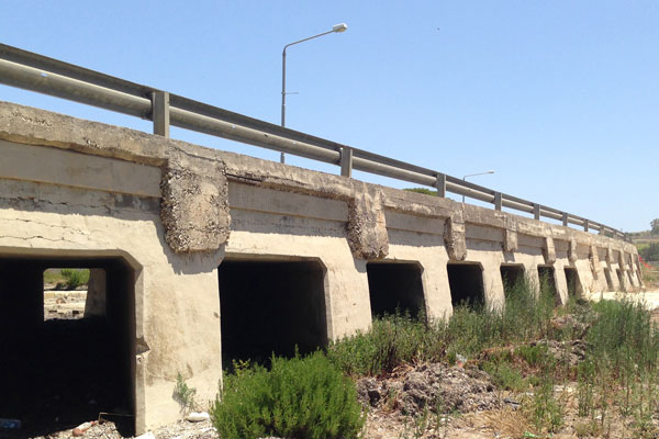
Near St Paul’s Bay, the route becomes the Salina Coast Road and crosses low-lying disused salt pans that flood regularly. A buried channel, infilled with very soft alluvium up to 30m thick, lies directly beneath the road.
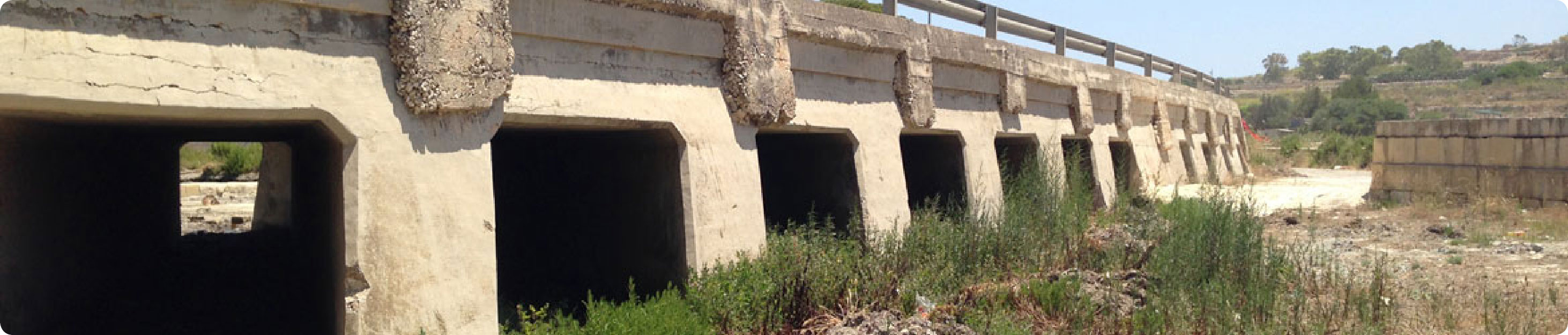
The original road was built on a concrete walled embankment sitting on a shallow concrete foundation, including numerous culverts to allow water to flow to the sea during heavy rainfall.
Transport Malta’s original plan was to widen the road by building the two additional lanes on rock fill embankments and elevated concrete structures founded on bearing piles. During tendering, contractor KOSTA joint venture proposed a more cost-effective alternative, replacing the piles with a floating raft.
SCOPE OF WORK
Harrison Group Environmental was engaged as KOSTA JV’s geotechnical engineer for the project, supervising site investigations, carrying out ground modelling and developing geotechnical design, as well as providing construction advice.
Ground investigation
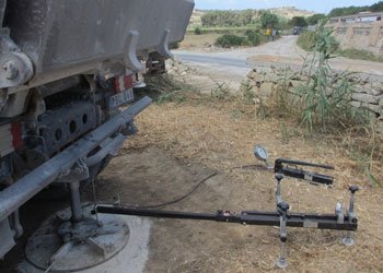
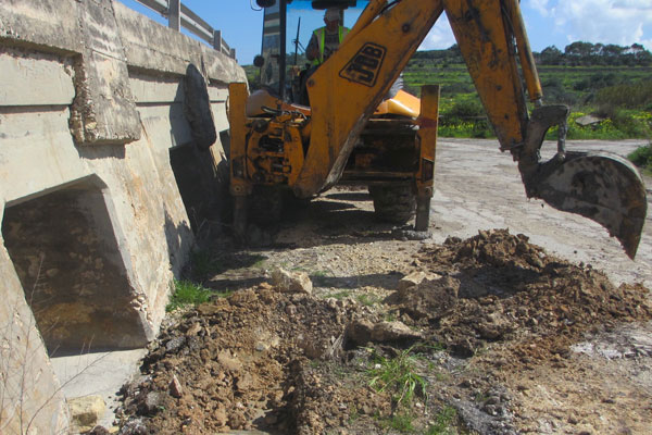
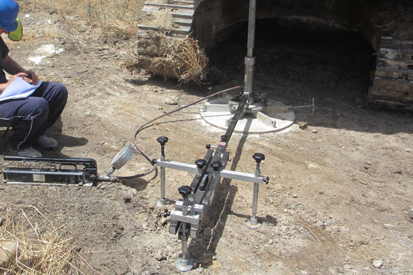
A ground investigation was undertaken in summer 2014, comprising:
Four boreholes to a maximum depth of 33m, with undisturbed Shelby thin wall samples and SPTs
Six plate load tests at ground level, with an additional test at 0.75m depth, with trial pits excavated to 4m at each location
Ground conditions comprised a crust of made ground and alluvium overlying soft to very soft alluvial clays, silts and fine sands, with Lower Coralline Limestone at depth. The buried channel is up to 31.5m deep, with an 11m thick limestone gravel layer infilling the deepest section. Groundwater was at sea level, typically lying at the base of the crust.
Samples were tested by Solidbase Laboratory of Malta. Moisture contents in the alluvium were close to the liquid limit, which meant the clays were too soft to test. The results of the plate load tests indicated an undrained shear strength of 10kN/m2 at the top of the alluvium.
Geotechnical analysis
Geotechnical analysis aimed to predict the bearing capacity and consolidation characteristics of the alluvium, as a key issue was the potential overstressing of the soft alluvial soils. Loads were at their greatest beneath the new elevated section, coinciding with the thinnest crust.
Analysis showed that following initial consolidation, when pore pressure dissipated, the strength of the ground would increase. This meant the alternative solution was feasible, if construction was phased to mitigate the risk of bearing capacity failure of the alluvium, and excesive differential settlement.
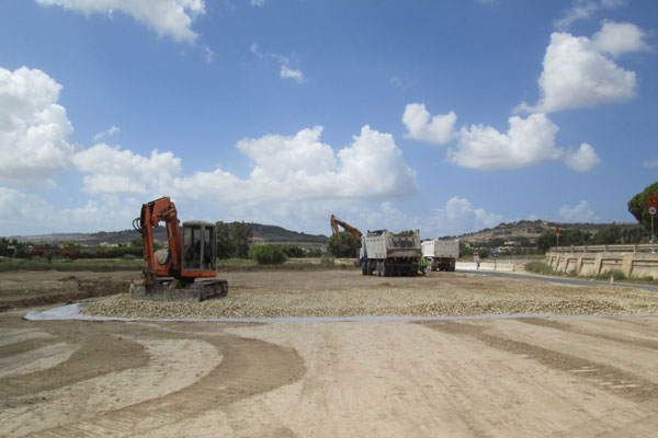
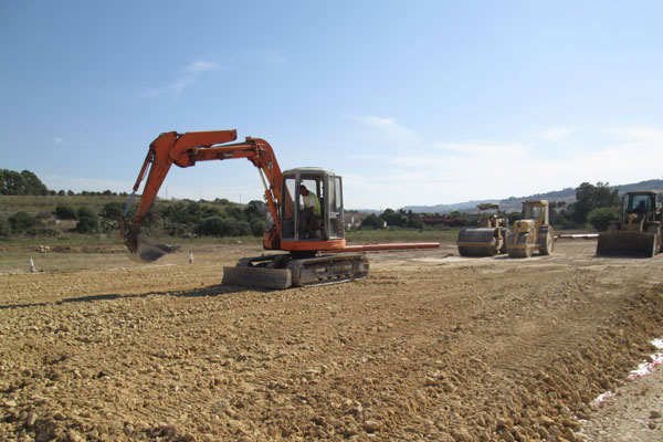
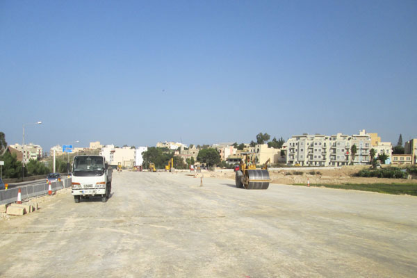
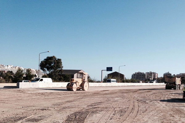
Construction
The final design comprised up to 1.8m high rock fill embankments at either end of the elevated concrete section, founded on the raft foundation.
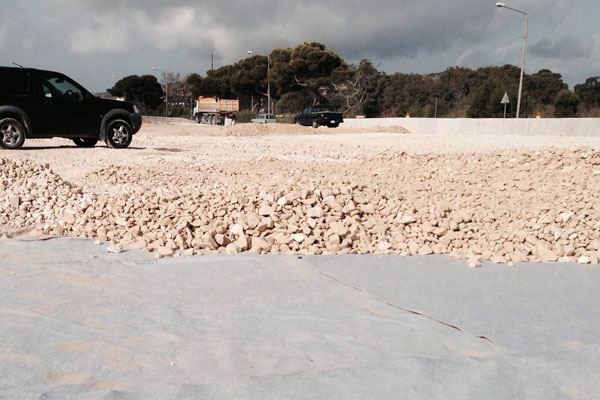
The crust provided stiff ground for construction, so a geotextile was laid along the alignment to protect it from construction traffic. Beneath the embankment sections, this was covered with a 350mm thick drainage layer and another geotextile, laid at 90°.
This separator layer prevented differential settlement of the compacted rock embankment fill and provided additional structural stiffness. The embankments were built up in stages to pavement level and the final surface laid, once settlements had reduced to acceptable levels.
Splayed wing walls were built where the embankments met the elevated road section. This concrete structure is up to 2.35m high and incorporates drainage culverts, with the spaces between filled with compacted rock fill or lean mix concrete. Settlement was controlled by building the structure to the top of the culverts by the winter (to prevent the flow of flood water), without adding the roof slabs and road structure above. This reduced immediate loads by about 18kN/m2.
OUTCOME
Construction began in April 2014 to ensure that significant progress was made by winter. The road was due to open in summer 2015 but the discovery of significant archaeological remains pushed back completion to late 2015. Construction of the elevated section was not affected, however, and the alternative design was deemed to be a great success. Not only was it innovative, it saved an estimated €400,000 on the original project budget.