Archives: News

Latest news from the Harrison Group

UKAS Accreditation by Remote Surveillance

December 30, 2020

UKAS Accreditation by Remote Surveillance

Under strict COVID-19 restrictions, Harrison Group has recently undertaken the annual UKAS Accreditation Remote Surveillance Audit for its independent soil testing laboratory. This was carried out with the aid of Teams, OneDrive and WeTransfer and is a first for the company.


Over a period of a month, 15 videos of between five to ten minutes duration were prepared of the procedures.


The feedback received was excellent. Zero non-conformances for testing were recorded and there were no recommendations made for improvement.


Whilst a major effort was needed to produce the video material, it is now also a useful resource for the company, to be used for future training and accreditation purposes.


Well done to Henry Chapman, Matthew Wilson and the laboratory technicians for their hard work in gaining this latest accreditation for the laboratory, which is another example of how Harrison Group is adapting in the current climate to maintain its high standards.


Perfect Delivery Achieved by Harrison Group

December 21, 2020

Perfect Delivery Achieved by Harrison Group

Harrison Group has been awarded ‘Perfect Delivery’ by Morgan Sindall for the work carried out  at the West Suffolk Operational Hub. Delivered through the Suffolk County Council framework, this is a project that has centralised, improved and transformed waste management across the region. The project was delivered on time, in budget, 100% Safe and scored 9/10 for customer satisfaction.


90% of Morgan Sindall Group’s project spend was with local SME’s of which Harrison Group was a part.


The work was carried out in a number of phases by Harrison, between 2017 – 2019 and involved geotechnical site investigation, in-situ testing and consulting. The project was managed from our Cambridge office with Jamie Austin at the helm for the duration of the works.

Light Weight Deflectometer Capability for Harrison Group

December 15, 2020

Light Weight Deflectometer Capability for Harrison Group

The Light Weight Deflectometer (LWD) apparatus is used to provide in-situ measurement of the foundation surface modulus (E) of the subgrade for use in pavement design. It is also useful in compaction control for bound and unbound base layers and sub-bases.


The foundation surface modulus is a measurement of the stiffness of the layer upon which the test is undertaken in terms of transient deflection caused by the application of a dynamic stress through a circular plate. The test method is set out in BS 1924-2:2018, 9.2 “Hydraulically bound and stabilised materials for civil engineering purposes, Part 2, Sample preparation and testing of materials during and after treatment” but is also referenced in ASTM Standard E2583-07: 2011 “Standard test method for measuring deflections with a light weight deflectometer (LWD).”


The standard test equipment comprises a 300mm diameter plate which is dynamically loaded through a buffer system to produce a load pulse of 15 ms to 30 ms duration using a 10kg weight falling from a variable height (generally less than 1m) to impart a target stress in the order of 100kN/m2 (100+/-5 kN/m2). The actual stress imparted is measured by a load cell within the equipment and the resulting deflection is measured by a geophone in the centre of the plate to a precision of +/-2µm.


Read more

Site set-up

LWD apparatus

Information. BSI – Latest Updates: 29.06.2020

June 29, 2020

Information. BSI – Latest Updates: 29.06.2020

BS 5930 Code of Practice for Ground Investigations has been amended. BS 5930:2015 +A1:2020 has just been published. The amendment contains the following main changes from BS 5930:2015.


  1. Update to ground investigation and geotechnical design in accordance with the latest BS EN ISO test standards meaning that different methods of work should not have to be adopted when operating in different countries.
  2. Update to description of soils and rocks in accordance with BS EN ISO 14688 (Book 3D7):
        • Geotechnical investigation and testing – identification and class of soil Pt 1. Identification and description and
        • Geotechnical investigation and testing – identification and class of soil Pt 2. Principles for a classification
  3. and 14689 standards (Book 3D7):
        • Geotechnical investigation and testing – identification and class of rock (ISO 14689-2017)
  4. Update to accommodate changes in BS EN ISO 17892 standards and related BS 1377 parts; more specifically:-.
        • Geotechnical investigation and testing- laboratory testing of soil Pt.1 Determination of water content
        • BS EN ISO 17892-2.2014 Geotechnical investigation and testing- Laboratory testing of soil Pt.2 Determination of bulk density
        • Geotechnical investigation and testing. Laboratory testing of soil. Determination of particle density
        • Geotechnical investigation and testing. Laboratory testing of soil. Determination of particle size distribution
        • Geotechnical investigation and testing. Laboratory testing of soil Incremental loading oedometer test
        • Geotechnical investigation and testing. Laboratory testing of soil. Pt 6 Fall cone test
        • Geotechnical investigation and testing. Lab testing of soil. Pt 7 Unconfined compression test
        • Geotechnical investigation & Lab Test of soil Part 8. Unconsolidated undrained triaxial test


Relating this information to BS 5930:2015 +A1:2020, the changes can be referenced as follows:


      • Chapter Topic Pages
        5.3 New communication- Asbestos 12
        10 3 dimensional ground model reference 18
        14.2 Topographical mapping, imagery and 3D 24/25
        33.4.5 Anthropogenic ground (table 18) 112/113
        33.5 Name, age and type of geological unit 116
        36.2 Description of rock materials (table 25) 121
        36.2.6 Rock name (commentary) 125
        36.4.2.2 Weathering classification Figure 9 128/129
        44 Field Density, SRDs and Electrical test 148/149
        57.2 Screening of Laboratory Samples containing hazardous samples. Safe to test information 191
        61 Laboratory tests- General  (tables list) 194
        Table 37 Common Laboratory Tests for Soils (table) references 195-207
        Sect 10, 62 Reports, Interpretation, Notes and references 212
        63.2.3 Photography, imagery, format (samples etc.) 219
        Annex G 1. Integrated field investigations (note) 261

In addition to this:

BS EN ISO 21365:2020 Soil Quality. Conceptual site models for potentially contaminated sites has been published and is available from the BSI bookshop.

1 Scope
This document provides guidance on developing and using conceptual site models (CSMs) through the various phases of investigation, remediation (if required), and any subsequent construction or engineering works.
It describes what CSMs are, what they are used for and what their constituents are. It stresses the need for an iterative and dynamic approach to CSM development.
This document is intended to be used by all those involved in developing CSMs and by those who rely on using them such as regulators, landowners, developers, and the public (and other relevant parties). Ideally, this includes representatives from all phases of the investigative and remedial processes, for example, preliminary assessment, detailed investigation, baseline human health and environmental risk assessments, and feasibility study, and, any subsequent construction or engineering work.

NOTE 1 This document is applicable whenever the presence of “potentially harmful” or “hazardous” substances are present irrespective of whether they are naturally occurring or present due to human activity (i.e. are “contaminants”).

NOTE 2 Although most of the principles described for developing CSMs in this document can apply to other domains, such as groundwater resources management, the present document is specifically written for the management of potentially contaminated sites or known contaminated sites.

Harrison Achieves Latest UKAS Certification of Accreditation During Lockdown

May 15, 2020

Harrison Achieves Latest UKAS Certification of Accreditation During Lockdown

Harrison Group is very pleased to announce that, on 5th May, its soil testing laboratory achieved certification to the latest UKAS standards.

 
Between them, Henry Chapman, General Manager-Testing Services, and Matthew Wilson, Laboratory Manager, attended British Measurement and Testing Association (BMTA) and UKAS transition workshops to prepare for the changes required.
Under the guidance of Henry, laboratory staff, Matthew, Graham and Conor worked methodically over the past two years, to completely rewrite the laboratory manual, along with all operating procedures and processes, to align with the new standard.
As a result of this, the recent successful transitional audit has advanced the laboratory from the 2005 standard to the 2017 level – ISO/IEC 17025:2017– General Requirements for the competence of testing and calibration laboratories.
Steve Williams, Managing Director of Harrison Group commented.

“Although the past two months have been very challenging for us, we remain positive as we strive to maintain the high standards that we have set ourselves. We have adapted well to the current restrictive environment, and our consultants and engineers have been following the necessary guidelines as they work safely with our clients.

“Gaining the latest UKAS accreditation is part of our preparedness for the future, as we continue to provide the highest level of service and look forward to more normal times ahead. Well done to all staff involved.”

Harrison wins Keynetix Data Management Award

November 27, 2019

Harrison wins Keynetix Data Management Award

After receiving a commendation in 2018 for it’s application of data management to real-world ground investigation interpretation, Harrison Group went one better a year later.

On 25th November 2019, in a keenly fought competition, the company came out on top, for it’s contribution in the category of Data Visualisation. 

The Data Management Team at Harrison Group has developed a process to improve reporting, convey the risks and results highlighted by a site investigation, which can illustrate the need for further investigation.

The Problem
Although standard borehole log information can be passed easily onto clients, our challenge was to find a way of sharing effectively 3D model data of the site and borehole findings.

This would provide, via a rapid turnaround, a far more comprehensive interpretation of the site and ground situation, accessible to all parties, irrespective of the software packages that they may or may not be using.

The Solution
Utilising the QGIS 3D modelling plug-in, the data management team at Harrison Group developed templates which take the ground information from HoleBASE SI and process it into the data structure that works most effectively with the plug-in.

Through processing within the QGIS 3D modelling software, the data is represented as a 3D Javascript model, which can be viewed through a standard web browser.

This can be further enhanced. Not only can soil strata be modelled in QGIS, but more complicated geologies can be accurately represented by applying the Civil 3D extension to the data and then transferring across.
The Benefits for Harrison Group

  • Ease of access. Office users can work with data by clicking on elements within the model.
  • As a result the ease with which such 3D modelling can be carried out, informed decisions can be made for targeting features of importance while our geotechnical engineers are still on site.

The Benefits for our Clients

  • Factual data can be provided rapidly and clients can interact with the 3D model, allowing some level of analysis often whilst drilling teams and engineers are still on site.
  • Should anomalies be highlighted, further investigation can be instructed at the time, providing cost and time savings for our clients

Rachael Leech and Conrad Stewart of Harrison Group

Harrison Cambridge is Moving!

July 8, 2019

Harrison Cambridge is Moving!

The continued success of our Cambridge office has led to the growth of our team and the need to move to bigger premises; from 1 August we will be based at Fen Ditton, on the edge of Cambridge.

“We have been working in Cambridge for many years and set up an office here at the beginning of 2016.” said Principal Engineer Jamie Austin. “There are some great opportunities for us here, with lots of construction activity and demand for our geotechnical and geoenvironmental services has grown over the past three years. Moving into the new office will enable us to continue to expand our team and support our ever-growing client base of developers, housebuilders, contractors and consultants across the area.”


The new office is at:


1 Francis Court

High Ditch Road

Fen Ditton

Cambridge CB5 8TE


Our other contact details remain the same: Tel: 01223 781585; Email: info@harrisongroupuk.com


Investigating Asbestos Contamination in Soils

June 3, 2019

Investigating Asbestos Contamination in Soils

Asbestos can be a serious issue for developers, particularly of brownfield sites, with contamination occurring on the surface or more deeply in the ground. Assessing the type and amount of asbestos, and the risk it poses, requires specialist knowledge and experience, explains Harrison Group Environmental Associate Director Jon Archer.


Historically, many activities – from industry to agriculture and waste disposal – involved the use of the three main types of asbestos: Crocidolite (blue asbestos), Amosite (brown asbestos) and Chrysotile (white asbestos). Without careful management, these materials can find their way into the ground, following demolition of buildings and preliminary groundworks for example, presenting a serious issue for developers.


Investigation process


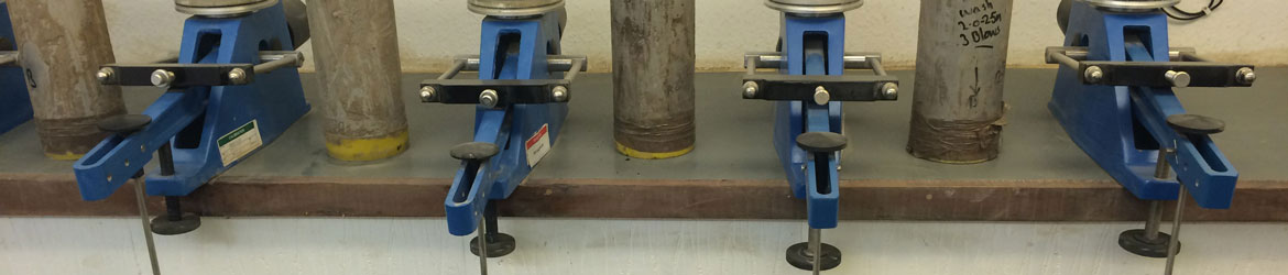
Like any other contaminated land investigation, the aim of an asbestos investigation is to identify the lateral and vertical distribution, quantity and type of asbestos in the ground (and also in the air). Importantly, while larger fragments of asbestos can sometimes be seen with the naked eye, soil can be contaminated by asbestos fibres that can only be identified under the microscope, in the laboratory.


CL:AiRE and the Joint Industry Working Group on Asbestos in Soil and Construction & Demolition Materials published Control of Asbestos Regulations 2012 Interpretation for managing and working with asbestos in soil and construction and demolition materials: Industry guidance in July 2016, which includes best practice approaches to investigations.


It recommends carrying out a desk study (as with any contaminated land investigation) to examine the site history, with the aim of identifying any previous use that could have involved asbestos, or any buildings that may contain, or demolished structures that may have contained, asbestos.


If there is potential for asbestos to be present, then a risk assessment is required before investigations begin and work must be carried out under an agreed plan of work (method statement).


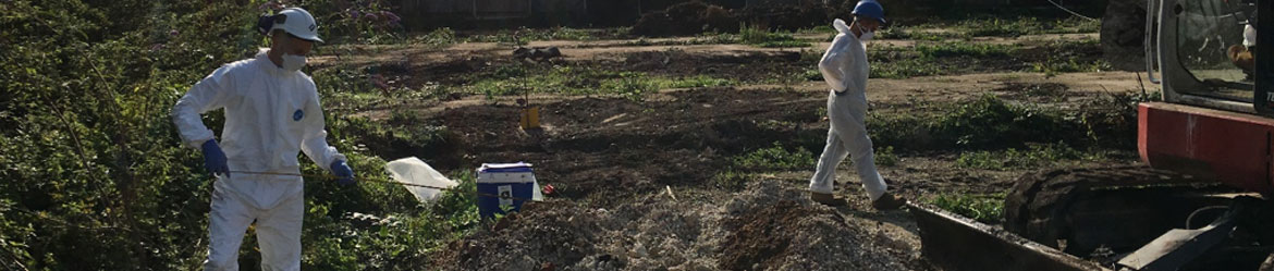
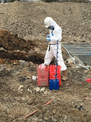
Asbestos investigations do not normally require a licence, if contamination is deemed to be ‘Sporadic and low intensity (SALI) exposure’. However, there is no ‘safe’ level of exposure, so if it is suspected that asbestos is present, then investigations should be carried out by trained geoenvironmental specialists with relevant skills and experience.


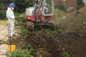
Along with appropriate PPE, such as protective clothing and respiratory masks, air monitoring for asbestos fibres should also be carried out throughout the investigation to protect site staff and the general public. In dry conditions, water spraying can be used to keep potential asbestos dust and fibres from spreading over a wider area.


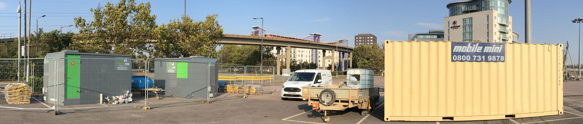
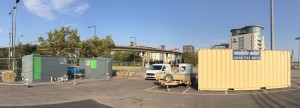
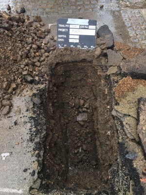
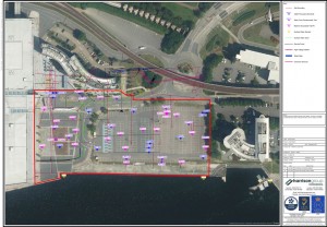
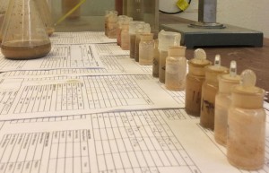
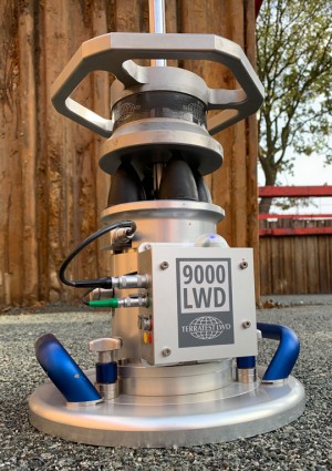
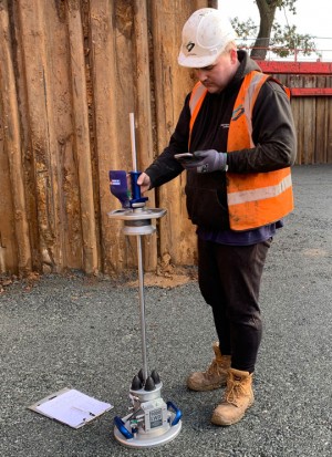
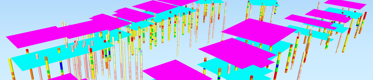
Intrusive investigations must provide good coverage of the shallow surface, to ensure that all made ground is investigated. Due to the likely widespread nature of asbestos contamination, trial pits or trenches (typically excavated by machine on a regular grid) are probably the best approach, as there is more chance of finding asbestos, followed by other techniques such as dynamic continuous sampling.


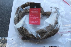
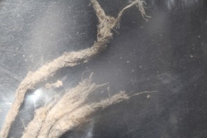
Samples collected should include any bulk fragments of potential asbestos found on the ground surface and in the ground, plus soil samples taken at regular intervals – this must be done carefully, to avoid introducing additional asbestos, so that the results are unbiased. Samples are sent to the laboratory to assess the amount and type of asbestos present.


It is worth noting that if asbestos is not identified in a sample, it does not necessarily mean that it is ‘clean’ or ‘uncontaminated’; it could be that the amount of asbestos is lower in the area from which it was taken and was not identified by the ‘point sampling’ approach.


Quantifying the risks


Following laboratory testing of samples, a quantitative risk assessment should be carried out, considering factors such as the nature and concentration of asbestos fibres and comparing these with background levels and likely exposure patterns.


CL:AiRE and the Joint Industry Working Group on Asbestos in Soil and Construction & Demolition Materials has also developed a decision support tool for receptor risk ranking, in accordance with the principles of CLR 11: Model procedures for the management of land contamination, for the qualitative assessment of asbestos risk using semi-quantitative methods supplemented by subjective assumptions.


These assessments can help determine the level of risk to the construction team, future occupants of the site and neighbours and, if necessary, inform the remediation strategy.


Remedial options


If remediation is required, a site-specific remediation statement needs to be developed and agreed with the local planning authority. Common approaches (which can be used in isolation or in combination), each with their own pros and cons, include:

  •  Soil stripping to a given depth, with soil passed through a mobile hand-picking line. This screening process aims to remove most of the bulk asbestos material. Screened soil should be sampled and tested before removal or reuse on site
  • Excavation of the soil mass for off-site disposal or treatment
  • Installation of a soil cover system in soft landscaping or garden areas. This involves excavating to a suitable depth, before placing a warning layer membrane, typically with 600mm of soil cover (subsoil and topsoil) above. The warning layer prevents mixing of the soil cover and the underlying made ground.

How Harrison Group Environmental can help


Soils contaminated with asbestos present a high risk to ground workers, future home owners and neighbouring residents. A comprehensive investigation, assessment and remediation strategy, developed and implemented by a specialist, is essential to ensure this risk is mitigated sufficiently.


Harrison Group Environmental has extensive experience in all aspects of contaminated land, including asbestos, carrying out desk studies, intrusive investigations, remediation and environmental risk assessments. Our competence and experience in assessing the risk and developing remediation strategies can save developers significant costs.


New guidance from the Association for Geotechnical and Geoenvironmental Specialists: Ground investigations – Work with asbestos risk assessement for the protection of intrusive ground investigation and laboratory personnel, is currently out for industry comment (April 2019).


Collecting samples for testing

Asbestos sample

Asbestos fibres

Investigation of suspected asbestos

Harrison’s Laboratory Renews UKAS Accreditation

April 9, 2019

Harrison’s Laboratory Renews UKAS Accreditation

Our in-house soils and materials testing laboratory UKAS accreditation has been renewed for another four years, following a successful audit in March 2019.


“The two-day audit is carried out every four years to ensure we continue to maintain the exacting standards of testing required by the United Kingdom Accreditation Service [UKAS],” said General Manager – Testing Services, Henry Chapman..


“Our laboratory is accredited to ISO/IEC 17025:2005 General requirements for the competence of testing and calibration laboratories. Accreditation has also been extended to include the calculation of the Uniformity Coefficient of granular material, using results from grading tests, which is commonly used in highways projects.”.


Henry said he hoped that more accredited tests would be added this year and said the laboratory manual was also being re-drafted to meet the requirements of the recently updated BS EN ISO/IEC 17025:2017 General requirements for the competence of testing and calibration laboratories. This will be used to confirm the competency, impartiality and consistent operation of a laboratory going forward from 2019 and beyond through UKAS..


For more information go to https://harrisongroupuk.com/soil-testing or contact Henry Chapman on 01603 613111.


Harrison Recycle Old Mobile Phones

March 22, 2019

Harrison Recycle Old Mobile Phones


As part of its’ Environmental Management System, Harrison Group is always working to minimise the use of single-use plastics and follows a comprehensive program of recycling materials that are in in everyday usage.


We have recently recycled 46 old mobile phones through a service offered by Oxfam. You may spot some familiar classics in the photograph – a few of them are still working!


Through the recycling process, if the phones are in a good enough condition to be refurbished, this will be carried out and they will be put to good use once again.


Mobile phones that are in a poor condition are passed on to specialist recyclers. They systematically dismantle each constituent part, and the materials – including precious metals – are then re-used in the industry.